
Key Features:
Filter and Display Locations with Ease
- Filter areas using custom fields, taxonomies, and region information effortlessly.
- Create multiple filters in the backend for flexible filtering options.
- Display posts, pages, and custom post types on Google Maps.
- Assign locations to your posts easily using meta boxes and custom fields.
- Utilize the Advanced Custom Fields plugin to manage location information for your posts.
Customize Info Display
- Showcase detailed posts information such as title, content, excerpt, featured image, categories, tags, custom fields, and custom taxonomies in info windows.
- Use placeholders to customize how this data is displayed.
- Display posts as a list below the map or present them within a customizable listing format.
- Allow visitors to change the display layout on the frontend.
Extensive Data Import
- Import unlimited location data from CSV files.
- Assign categories to your locations using CSV files with support for all delimiters.
- Apply multiple categories to a location and let visitors filter by these categories.
Enhance User Experience
- Redirect to a location or display info window data when users click on markers for both posts and manually added locations.
- Implement a comprehensive listing module to filter, sort, and search posts and locations by various criteria.
- Enable search for posts and locations within a specific radius.
Marker Clustering
- Utilize marker clustering for improved map performance when dealing with numerous locations.
- Choose from various marker cluster icons and customize the appearance.
- Configure marker cluster grid and max zoom level.
Create and Manage Routes
- Create routes in the backend and display them on the frontend.
- Assign colors to each route for easy identification.
- Let visitors show/hide routes using the filter form.
- Make routes draggable and optimize waypoints for the best route.
Shapes and Custom Styling
- Add custom shapes like circles, rectangles, polygons, and polylines on the map.
- Shapes are clickable and can redirect users to specific locations.
- Draw, modify, and save multiple shapes.
- Apply appealing Google Maps styles from snazzymaps.com or create your own custom styles for roads, labels, and geometry.
Data Integration
- Fetch location data from external sources like custom tables and APIs.
- Automatically extract latitude, longitude, city, country, administration, and zip code when entering an address.
- Manage parent-child categories and assign custom markers to categories.
- Use placeholders for dynamic infowindow content.
Interactive Map Features
- Apply various map animations such as bounce and drop on marker actions.
- Change zoom levels for better map visibility.
- Display KML/KMZ Layers and Fusion Tables data on the map.
- Show real-time traffic conditions with Traffic Layers and include bicycle routes using the Bicycling Layer.
Responsive and User-Friendly
- Customize map properties like height, width, zoom level, map type, and control settings.
- Ensure smooth user experience with fully responsive maps that adapt to different devices.
- Center the map based on the visitor’s location.
- Highlight the central location with a circle on the map.
Control and Permissions
- Manage map controls like Zoom Control, Full Screen Control, Map Type Control, and more.
- Hide markers on page load and display them after filtration.
- Implement Street View with customizable settings.
- Display overlays with various styling options.
- Track map panning and dragging for a focused user experience.
Flexible Data Display
- Easily display GEOJSON data using a URL.
- Show maps in regular and satellite views or switch between them.
- Embed Google Maps in sidebars using widgets.
- Display categories, directions, routes, and nearby tabs together on a single map.
- Showcase category-specific location counts and sort categories by the number of assigned locations.
User Management and Multilingual Support
- Keep backups of locations, routes, maps, and categories.
- Assign permissions to users to control access to location, categories, routes, and maps.
- Utilize external databases and sources to add markers to Google Maps using the instant filter wpgmp_marker_source.
- Add multiple Google maps on a single page, each with its unique properties.
- Enjoy cross-browser compatibility, including support for IE8, IE9, IE10, and other major browsers.
- Multilingual support via .po files.
- Multisite compatibility, allowing you to activate it network-wide.
Based on 0 reviews
Be the first to review “Advanced Google Maps Plugin for WordPress”
Related products
-
-
-
-
-
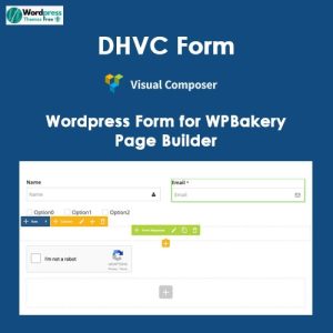
Forms, Plugin
DHVC Form – WordPress Form for WPBakery Page Builder
- Free & Original product!
- You will be given files that remain unaltered and unedited
- 100% Clean Files & Free From Virus
- Unlimited Domain Usage
- Free New Version
- Product Version : 2.3.10
- Product Last Updated : 07.03.2023
- License : GPL
SKU: n/a


There are no reviews yet.