
You have the capability to showcase a wide array of maps, encompassing:
- Global Perspective: Present a comprehensive map of the entire world.
- Continental and Subcontinental Views: Explore continents and their subregions, such as Africa, Europe, the Americas, Asia, Oceania, and their subcontinental divisions.
- National Focus: Dive into individual countries; virtually all countries worldwide are available, including highly requested ones like the USA, United Kingdom, Canada, France, Germany, Spain, Italy, Brazil, India, and Australia.
- Regional Breakdown: Examine countries further, dissecting them into their constituent regions.
- United States State-Level Detail: Zoom in on specific states within the United States.
- Metropolitan Area Insights: Delve even deeper by exploring the United States through its metropolitan areas.
- State-Level Metropolis Breakdown: Gain a finer understanding of individual states in the United States through their metropolitan divisions.
Colorize Regions or Incorporate Markers You can enhance your maps by introducing active, color-coded elements in two distinct manners:
- Regional Coloring: Apply vibrant colors to entire regions, be it a continent, subcontinent, country, province, or a U.S. state.
- Marker Placement: Opt for the placement of colored bubbles on chosen regions, which could represent cities, states, or countries.
Based on 0 reviews
Be the first to review “Interactive World Maps”
Related products
-
-
-
Forms, Plugin
Calendarista Premium – WP Reservation Booking & Appointment Booking Plugin & Schedule Booking System
 Forms, Plugin
Calendarista Premium – WP Reservation Booking & Appointment Booking Plugin & Schedule Booking System
- Free & Original product!
- You will be given files that remain unaltered and unedited
- 100% Clean Files & Free From Virus
- Unlimited Domain Usage
- Free New Version
- Product Version : 15.4.1
- Product Last Updated : 01.08.2023
- License : GPL
SKU: n/a -
Forms, Plugin
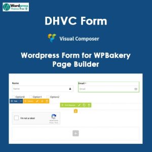
DHVC Form – WordPress Form for WPBakery Page Builder
- Free & Original product!
- You will be given files that remain unaltered and unedited
- 100% Clean Files & Free From Virus
- Unlimited Domain Usage
- Free New Version
- Product Version : 2.3.10
- Product Last Updated : 07.03.2023
- License : GPL
SKU: n/a -

There are no reviews yet.